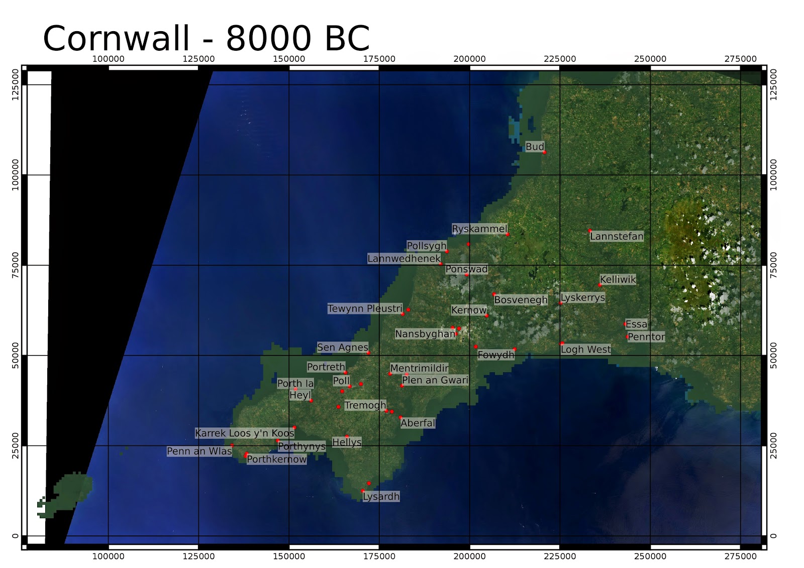
Sea level is based on Shennan and Horton 2002, with a triangular interpolation. Background is Landsat 8 from 25th July 2014. OSGB numerical coordinates.
The bathymetry is from GEBCO which has a 30 arcsecond resolution (about 600m at 50 degrees latitude). Higher resolution bathymetry is now available from the INSPIRE portal. I am planning to make some more detailed maps with this.
I've not removed man made structures including reservoirs and china clay pits. I have added a little semi-transparent dark green colour in the lower elevations to simulate dense forest in the valleys which is thought to have been the case in the Neolithic.
The Cornish name for St. Michael's Mount, is "Karrek Loos y'n Koos" - "The Grey Rock in the Wood".
 |
| Around the time period of the Younger Dryas stadial, estimated as 10,800 to 9500 BC. At the end of this stadial, the climate warmed rapidly to approximately present levels (Holocene temperature variations - Wikimedia commons). |
 |
| See NOAA Paleoclimateology program for details on the 8.2ka event (6200BC), where the glacial Lake Agassiz drained in the Hudson Bay region. Legend has it that the land of Lyonesse was drowned in a single great storm. |
 |
| The coastline 5000 years ago is broadly similar to today, though there are some areas such as the area near St. Michael's Mount (Karrek Loos y'n Koos) where land existed which is now submerged. In a future post I will produce a better map from higher resolution bathymetry which is now available from the INSPIRE portal. |


How did you gather the information to produce these images?
ReplyDeleteIts based on the paper by Shennan and Horton. Also look up Kurt Lambeck's papers. Landsat 8 satellite images are freely downloadable from USGS EarthExplorer, and the current elevation map from the Space Shuttle radar mission. I used QGIS software to put it all together.
ReplyDelete