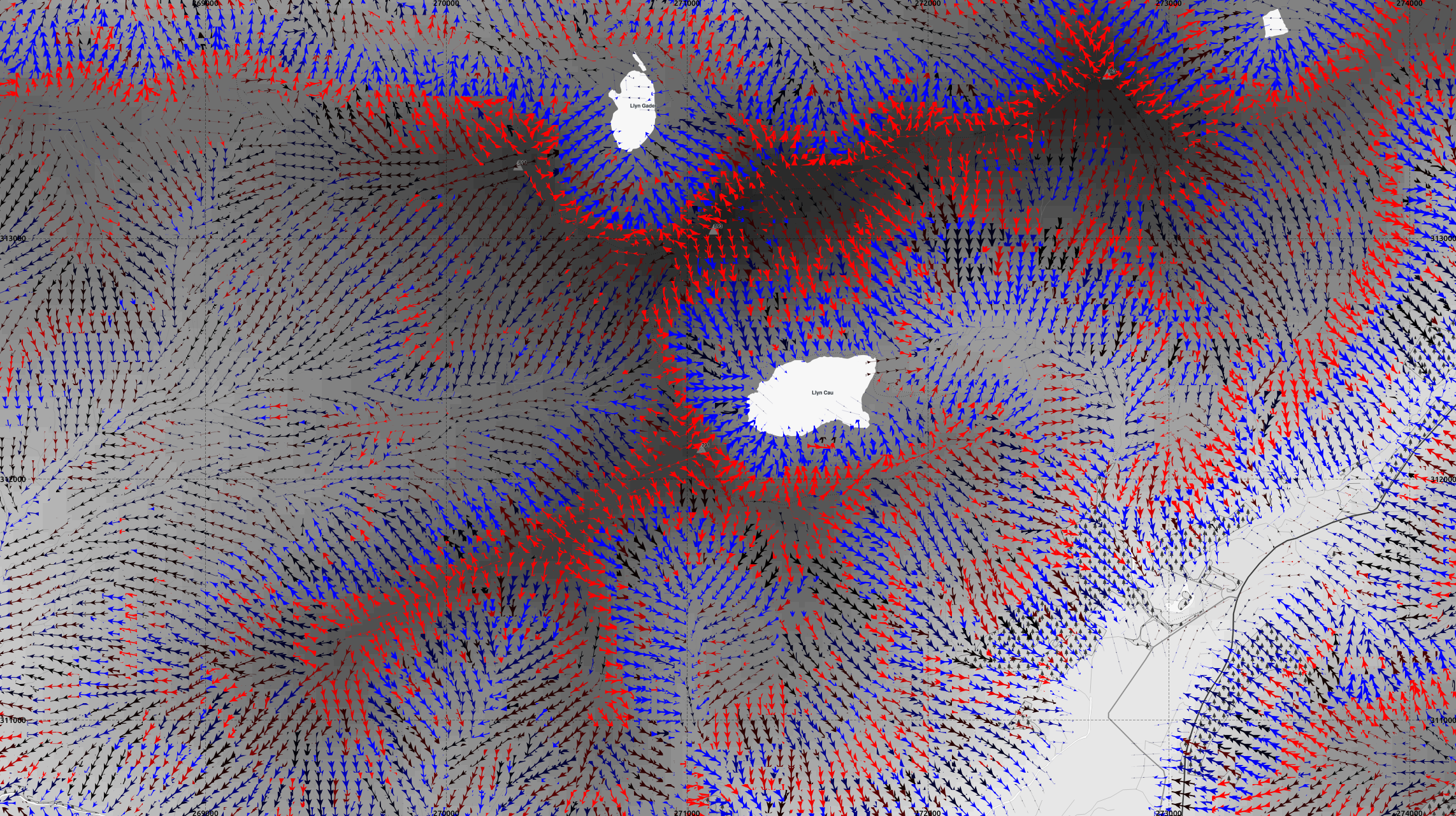
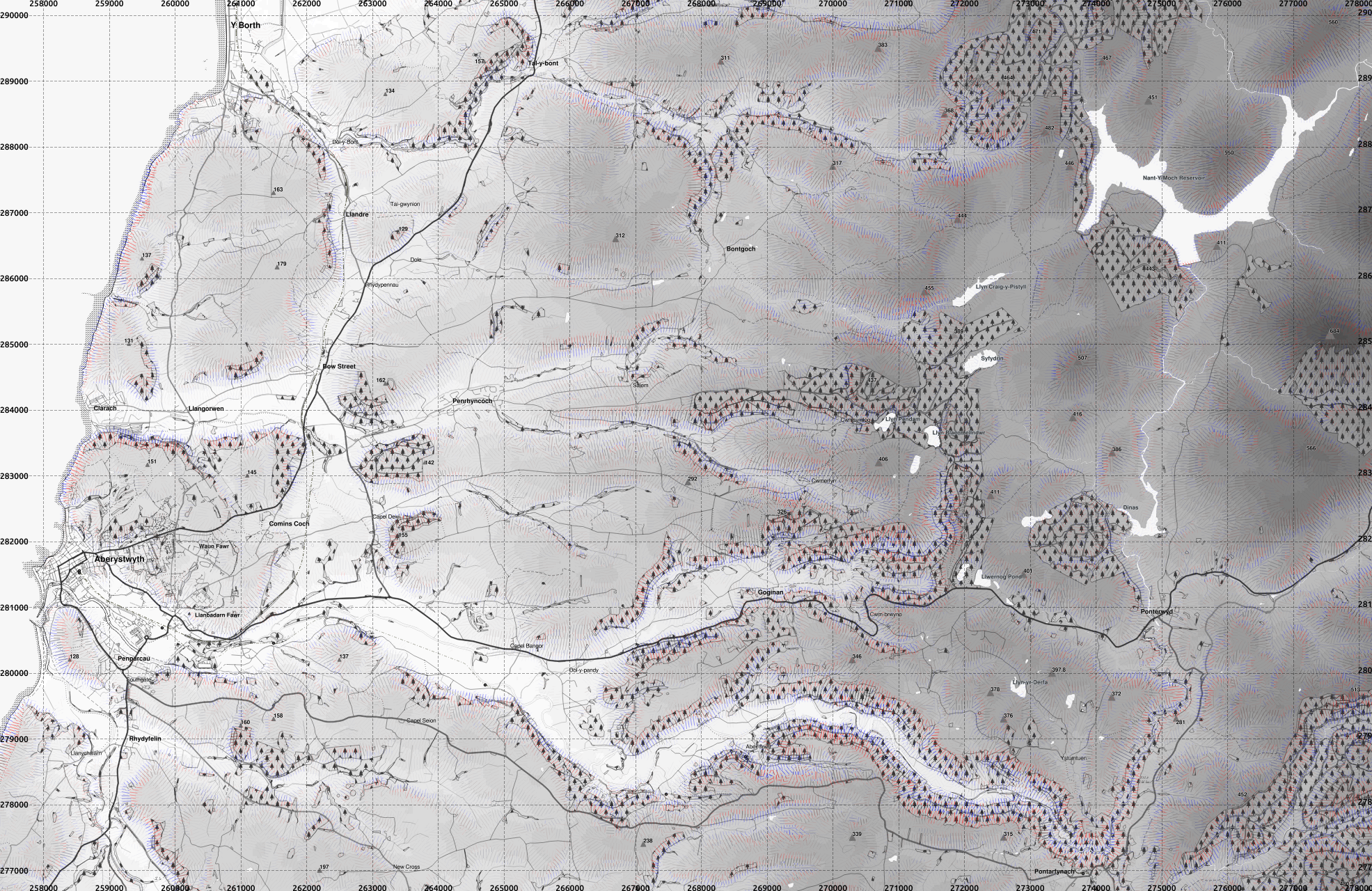
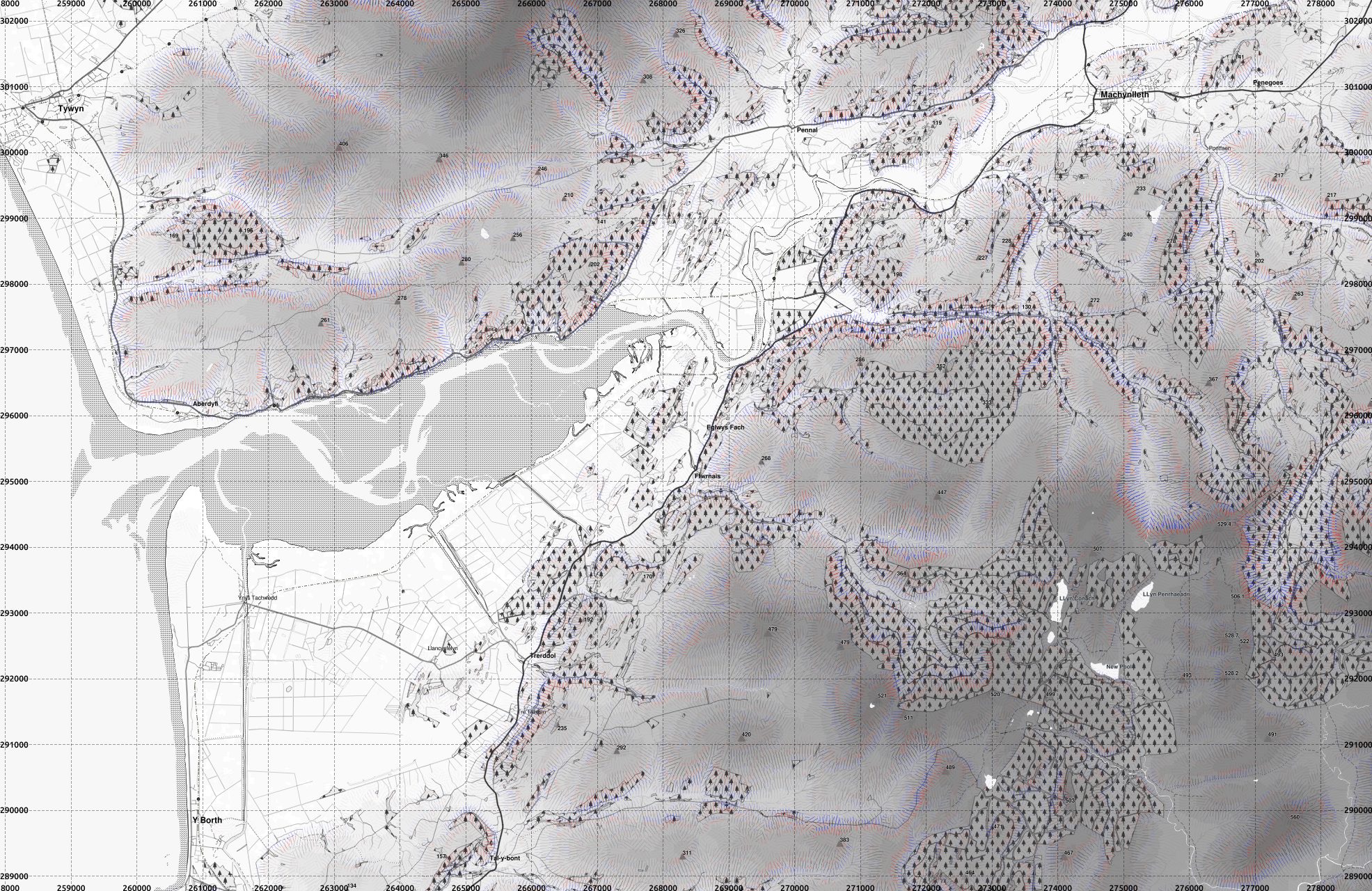
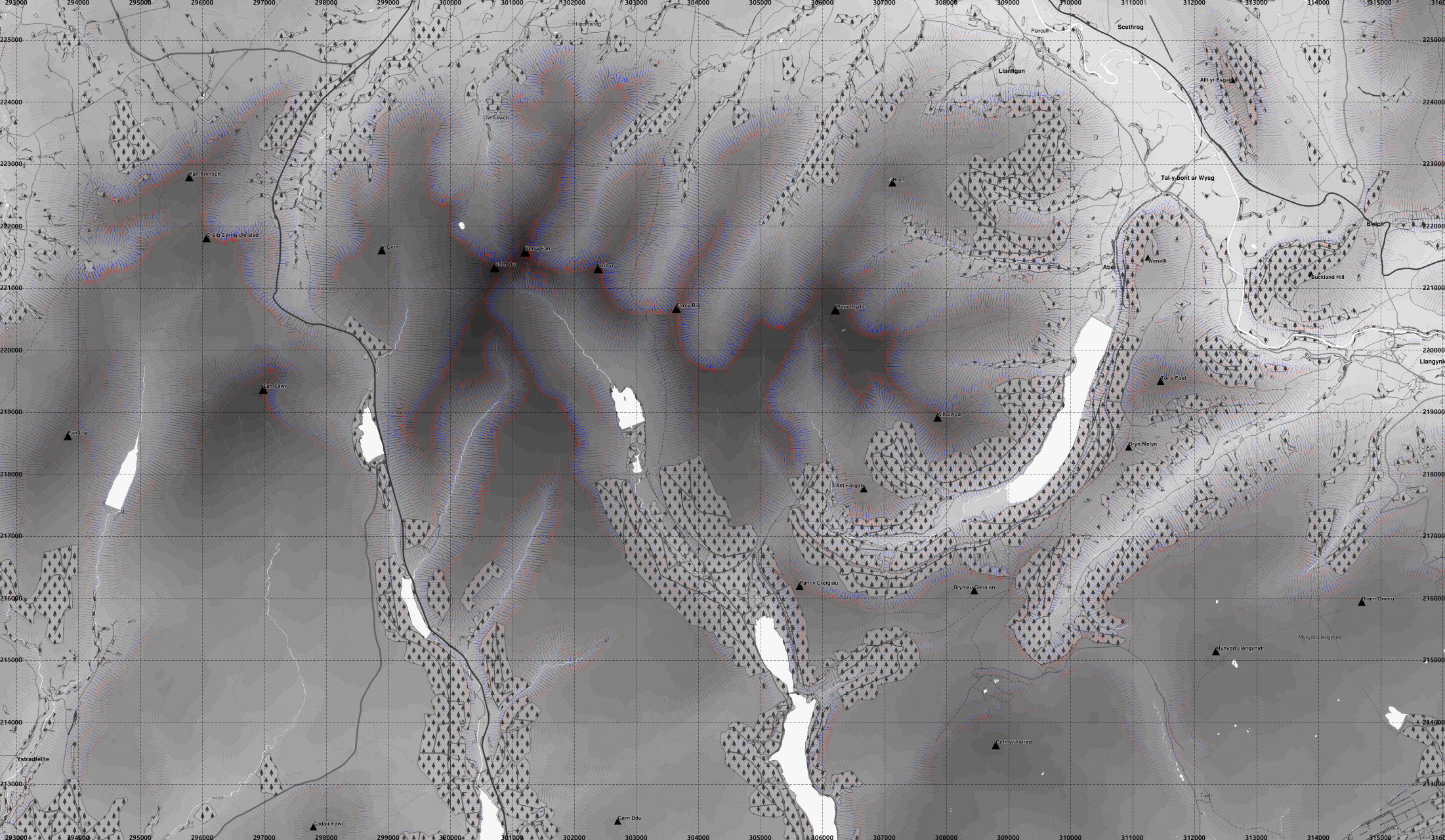
Here are a couple of maps of Aberystwyth, and Cadair Idris, with the RSGISlib segmented digital elevation model.
Slope direction is shown by arrows, and coloured in the same scheme as previously with thicker arrows for steeper slopes, and longitudinal curvature indicated with convex slopes red and concave blue.
1:10000 seems about the limit of the smallest scale that QGIS will cope with the arrowed lines. Beyond that the computer just hangs - slope lines without arrows can be plotted without problem.
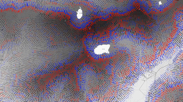 |
| Cadair Idris. This is a textbook example of a glacial landscape in the British Isles. full-res version |
To readers: are there any requests of areas you would like to see?
The processed data currently includes the following area though I also
have the whole of British Isles (except most of Shetland) DEM from 1
arcsec SRTM (and could download anywhere up to 60° latitude) but not
processed to create slope curvature layers and segmented.

Pen-y-fan area, Brecon Beacons
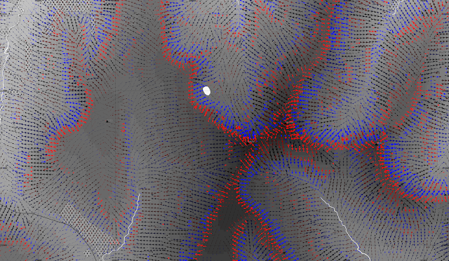 |
| Pen-y-fan main summit to the right of centre, showing the slopes convex at the top, but generally concave further down. full-res version |


Maybe the area around Pen y Fan ?
ReplyDeleteDone. Also added links to the original full-resolution versions.
ReplyDeleteExcellent - many thanks - those short thick swathes of red arrows followed by blue lengthening out are beginning to make sense even to me now.
ReplyDeleteSometimes blue to red, sometimes blue to black to red. Wonder what rock is under the black, steadily sloping arrows. Or what acted on them (or left them alone).
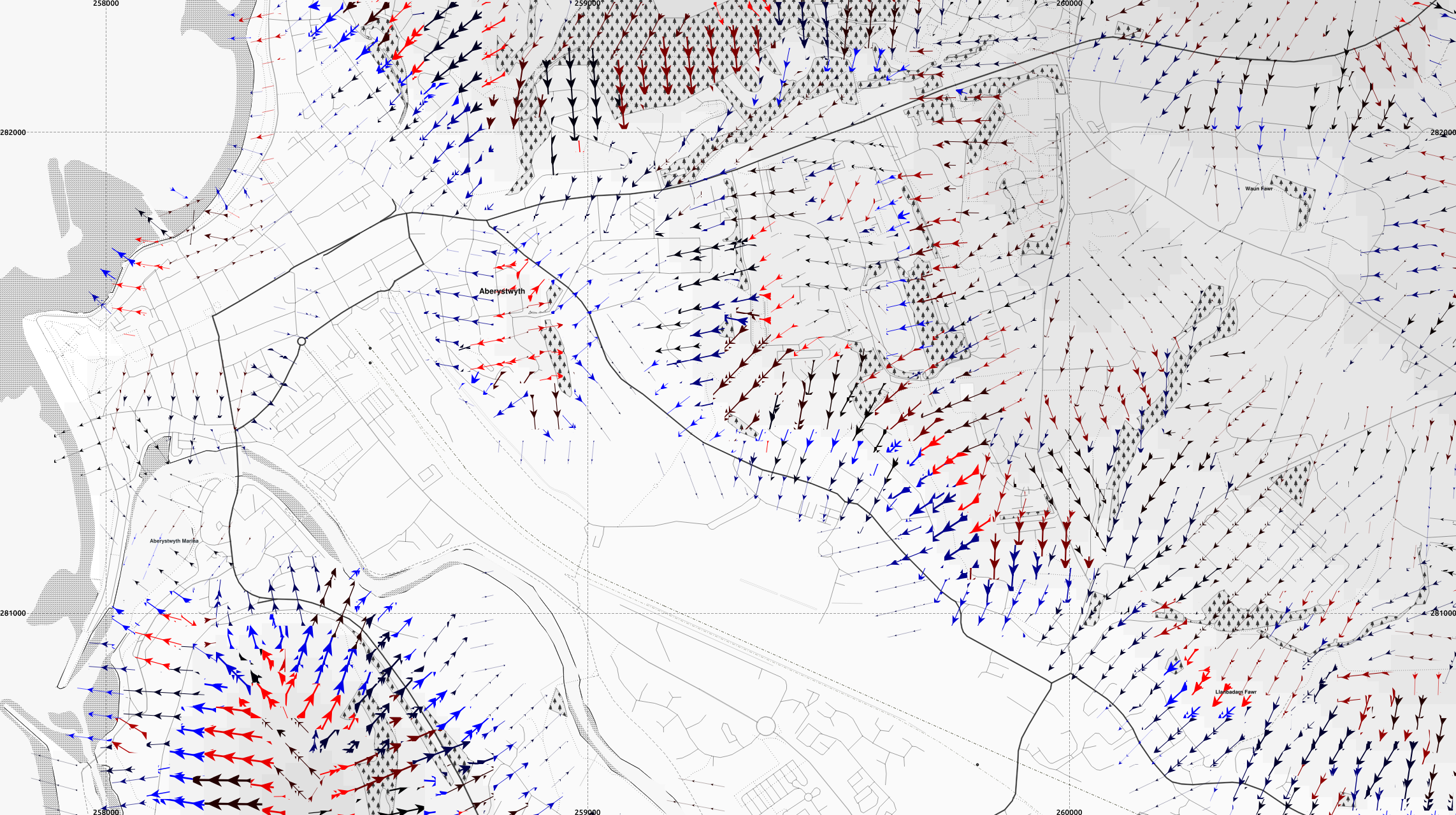
The walking routes look nice & easy with most of the arrows pretty orthogonal to their paths ! Very good map, thanks, well done.
I recommend you go to the Geology of Britain viewer from the British Geological Survey. The 1:625k data is available for download as Open Data.
ReplyDeleteI believe the concave (blue) slopes in places like Cadair Idris and Pen y Fan are the effect of past glaciation of the valleys.