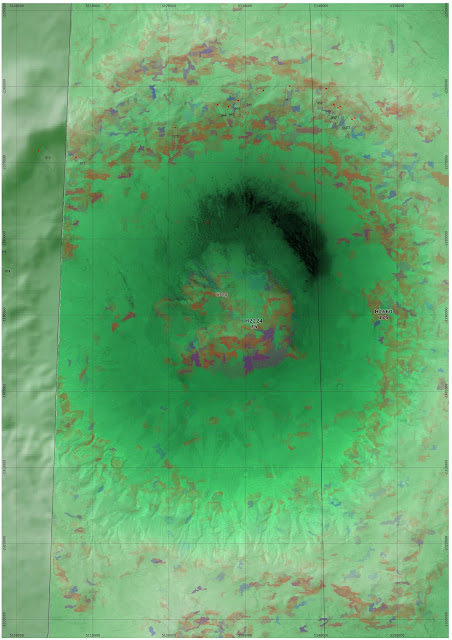
As an example, in part of the HRSC tile h2224, Colin Souness in his PhD work found a number of glacial like forms in the northern wall of the crater.
Greg crater is located at 38.5°S, 113.1°E and has a diameter of 66km.
The southern wall of the crater tends to be covered in gullies. There is a
detailed summary of it on the website of the Planetary Science Institute, Tucson, based on the W. Hartmann et al
paper.
Now looking at the classifier, labelling extent areas above ln(K) > 10 and head areas above ln(K) > 12. I have used "Addition" blending in QGIS to show areas that are classified in both in purple.
There are potential glacier source areas above the Souness objects, but there are many other areas that are also marked out as source areas that do not have glacier like forms catalogued by Souness, such as lower down the north face, the east face and the south face of the central mountain.
Google Earth can be useful to visualise Mars, selecting the CTX image mosaic (the 'context' camera with 6m resolution from Mars Reconnaisance Orbiter):
It is also possible to see where HiRISE coverage exists (red outlines):


No comments:
Post a Comment