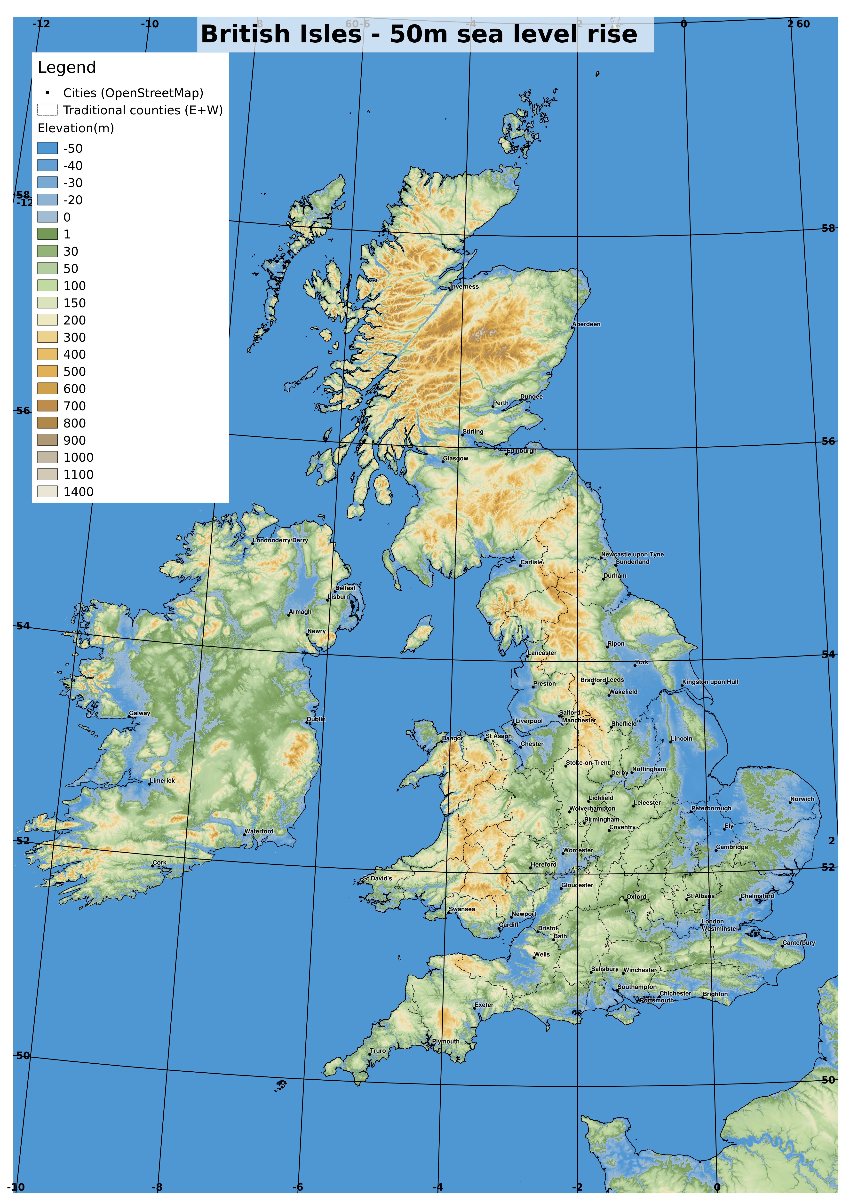
Since I have the 1 arcsec SRTM data ready to go for the British Isles, I thought I'd make a more detailed map for the
Meriga Project shared-world speculative fiction anthology for the British Isles. See my
last post for an explanation.
Some more detailed maps
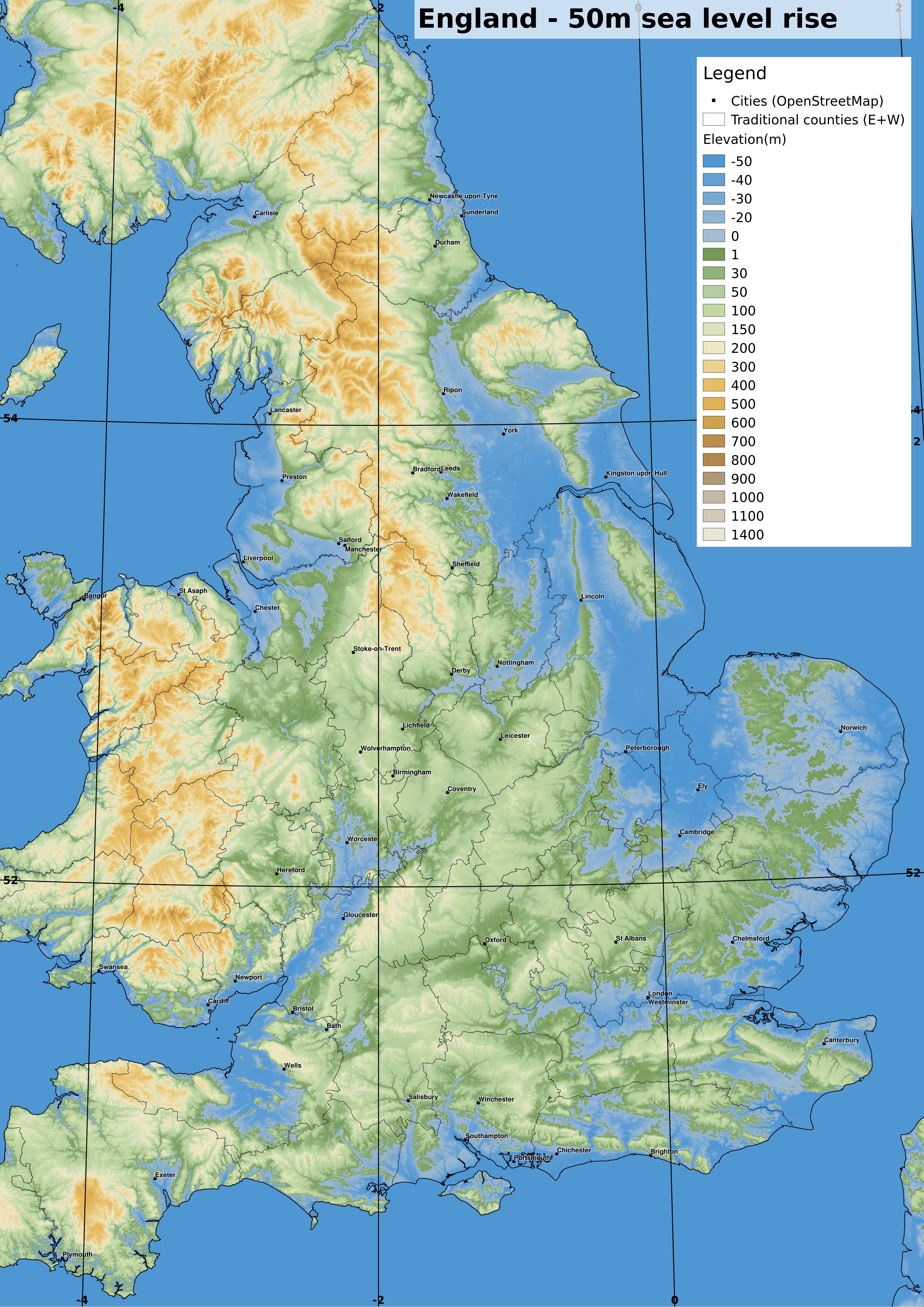
I have rendered some more detailed maps at a scale of 1:500000 at A3, of certain areas, which should now cover most of England and Wales, though I have not yet done Scotland and Ireland.
 |
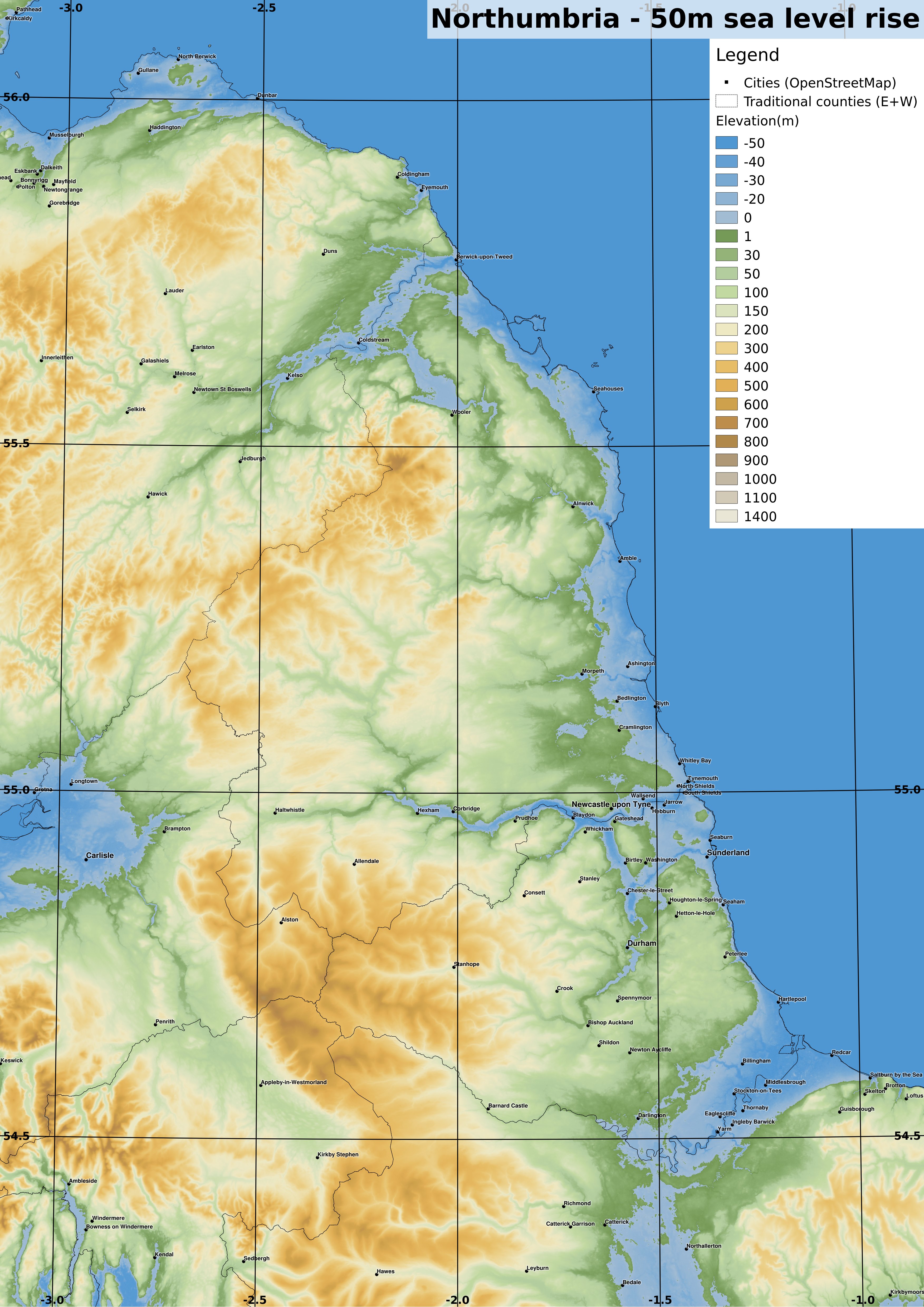
| OS grid ref projection. 1:500000 if printed at A3. The England-Scotland border now has a substantial inlet along the Tweed. The Tyne also reaches far inland. full-size version |
 |
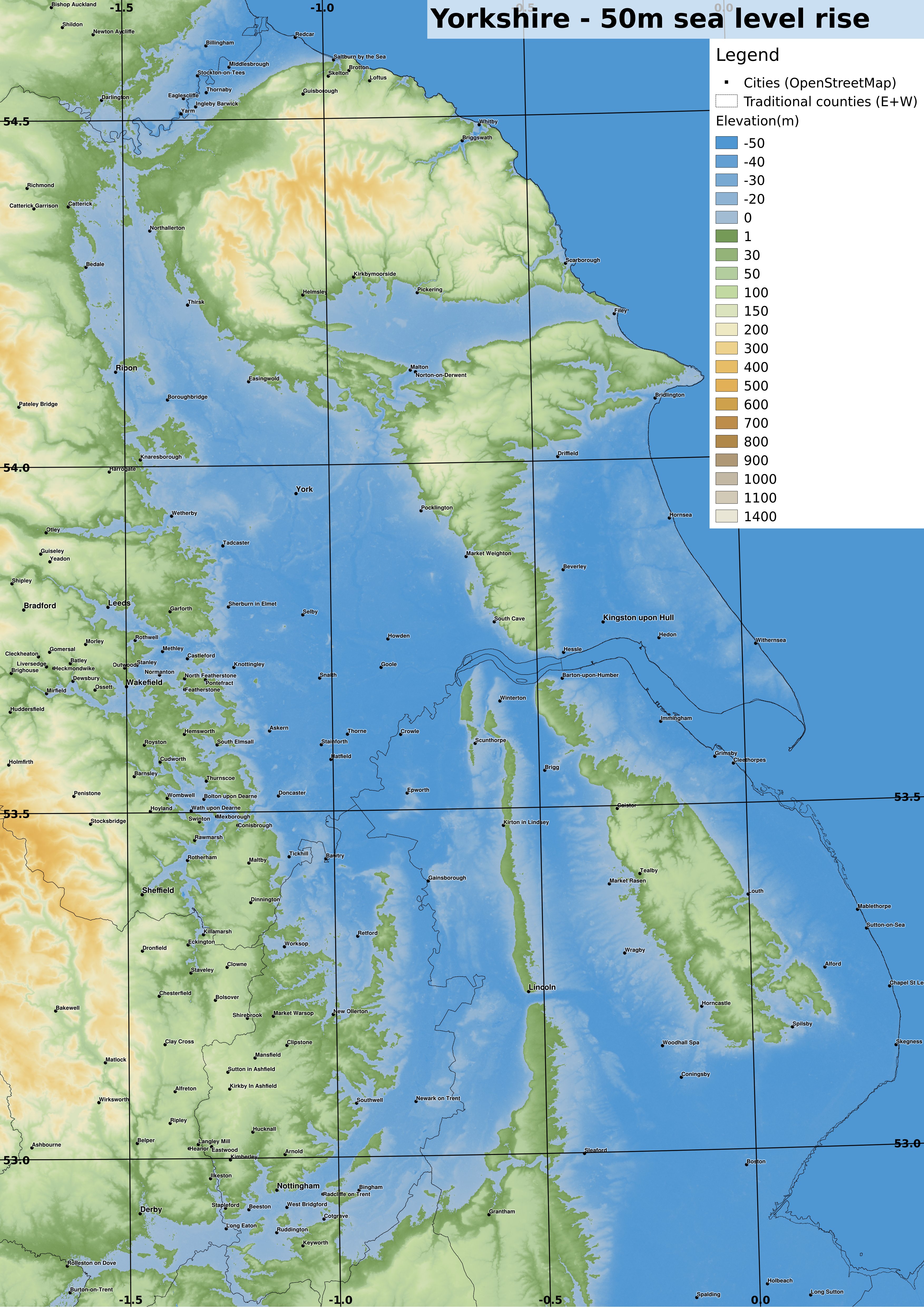
| OS grid ref projection. 1:500000 if printed at A3. Substantial flooding in the Vale of York results in the North York Moors now being an island, with other islands forming the remnants of Lincolnshire. full-size version |
 |
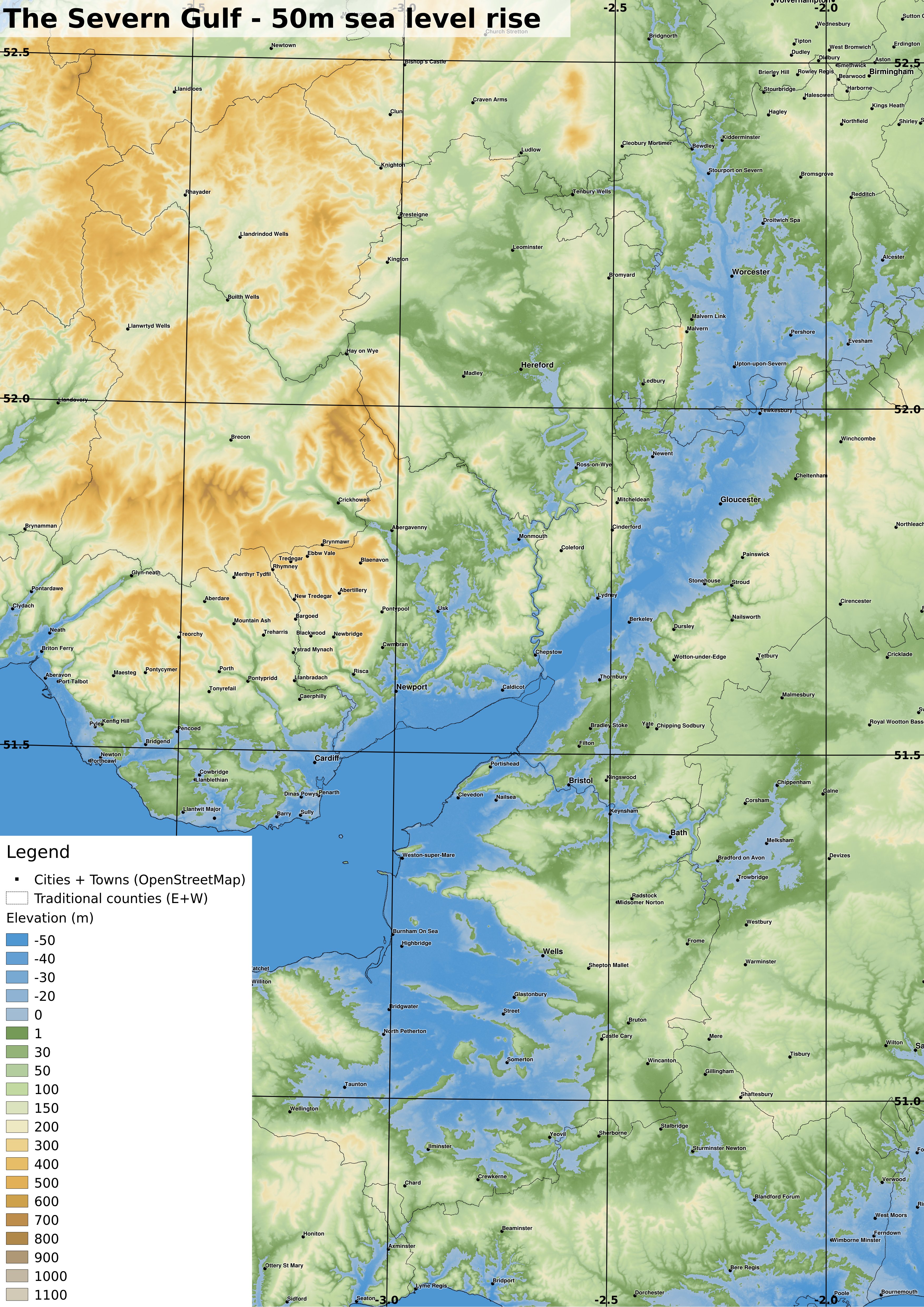
| OS grid ref projection. 1:500000 if printed at A3. The overland routes linking the expanded seas are now rather shortened. full-size version |
 |
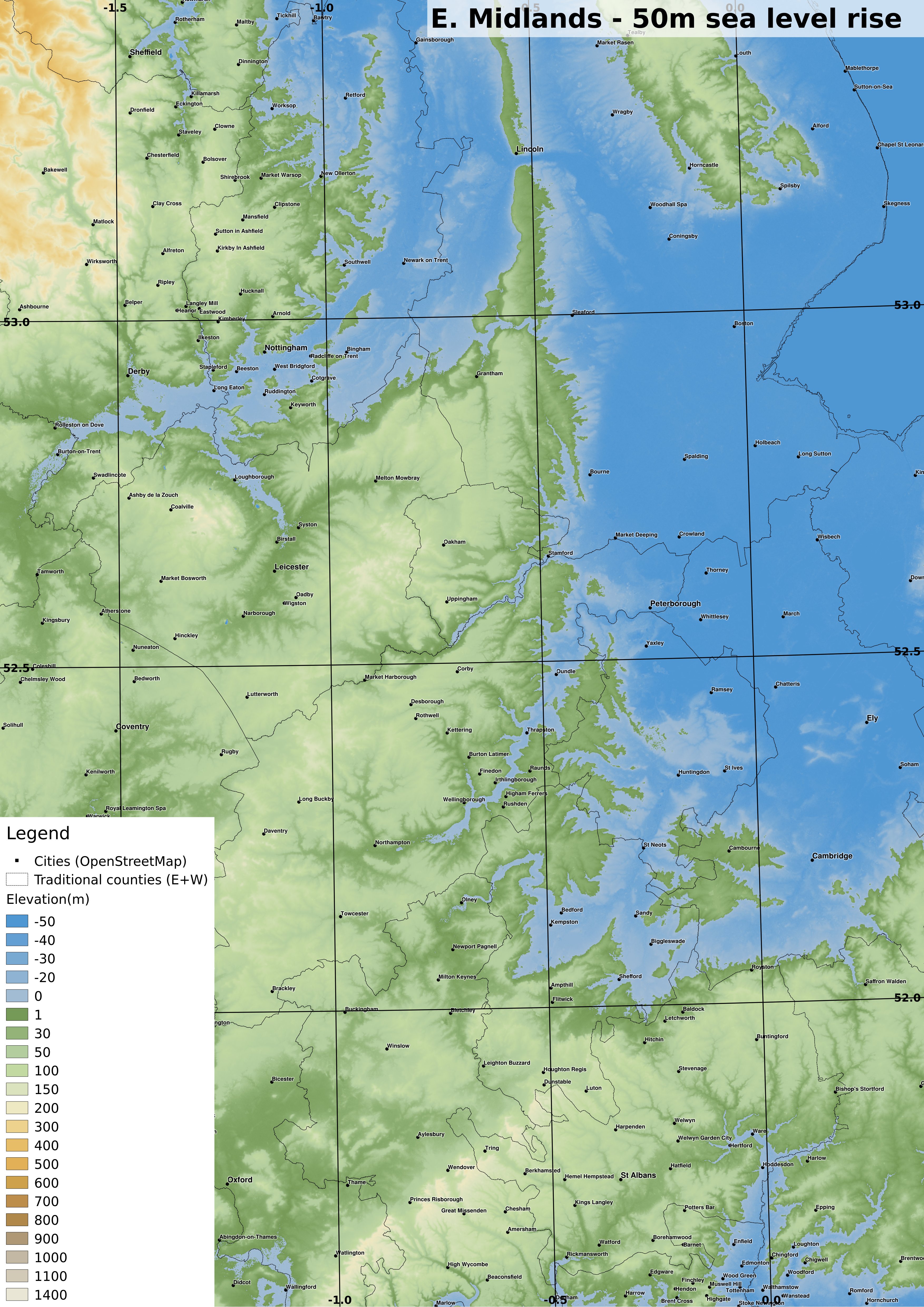
| OS grid ref projection. 1:500000 if printed at A3. Nottingham, Derby and Loughborough are now seaside towns. full-size version |
 |
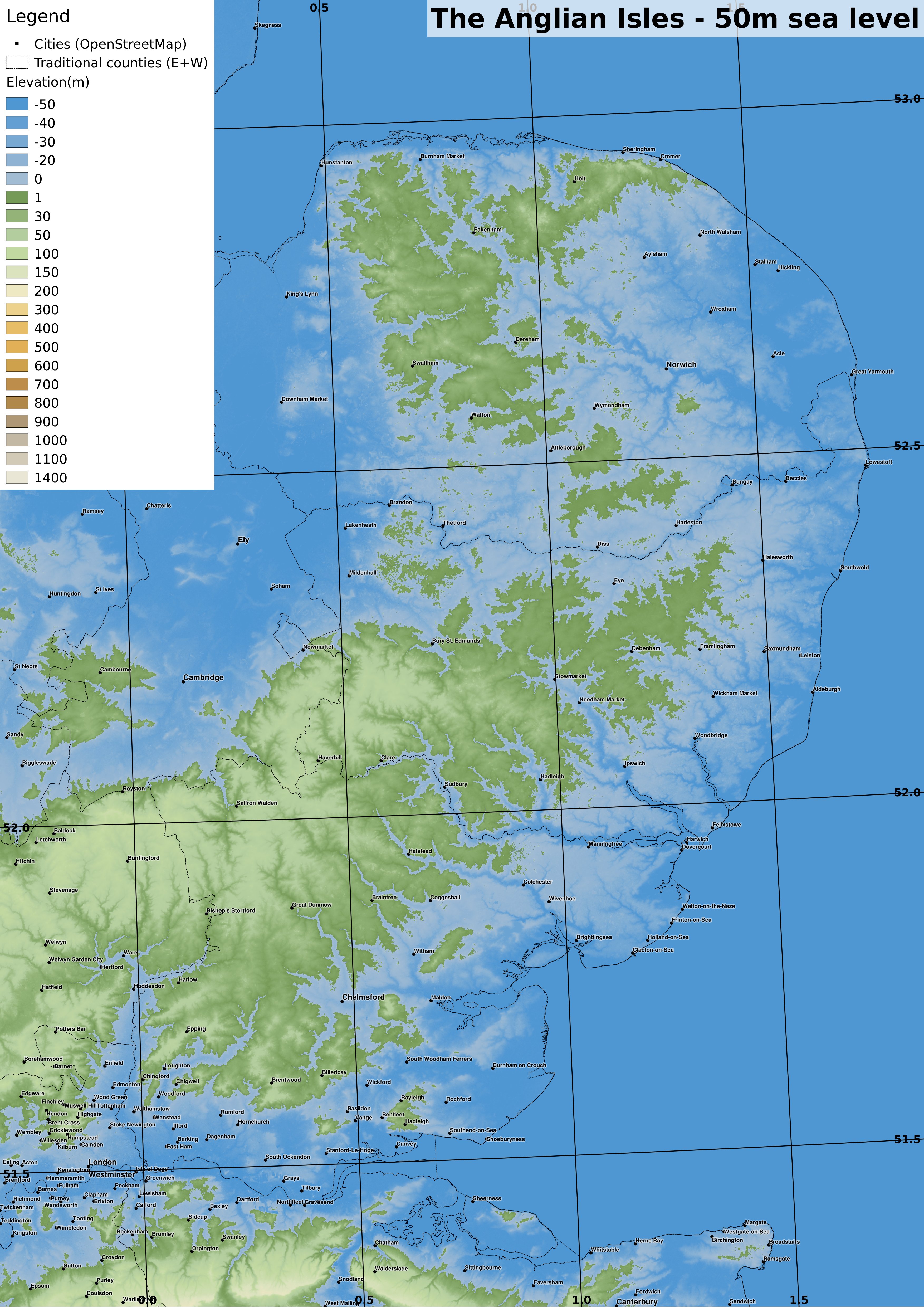
| OS grid ref projection. 1:500000 if printed at A3. The Anglian Isles are inhabited by people making the most of the declining land area. full-size version |
 |
| OS grid ref projection. 1:500000 if printed at A3. Perhaps central London was drowned catastrophically after the Thames Barrier (or its successor) failed. The technological limitations of this age make underwater salvage risky, but rewarding... full-size version |
 |
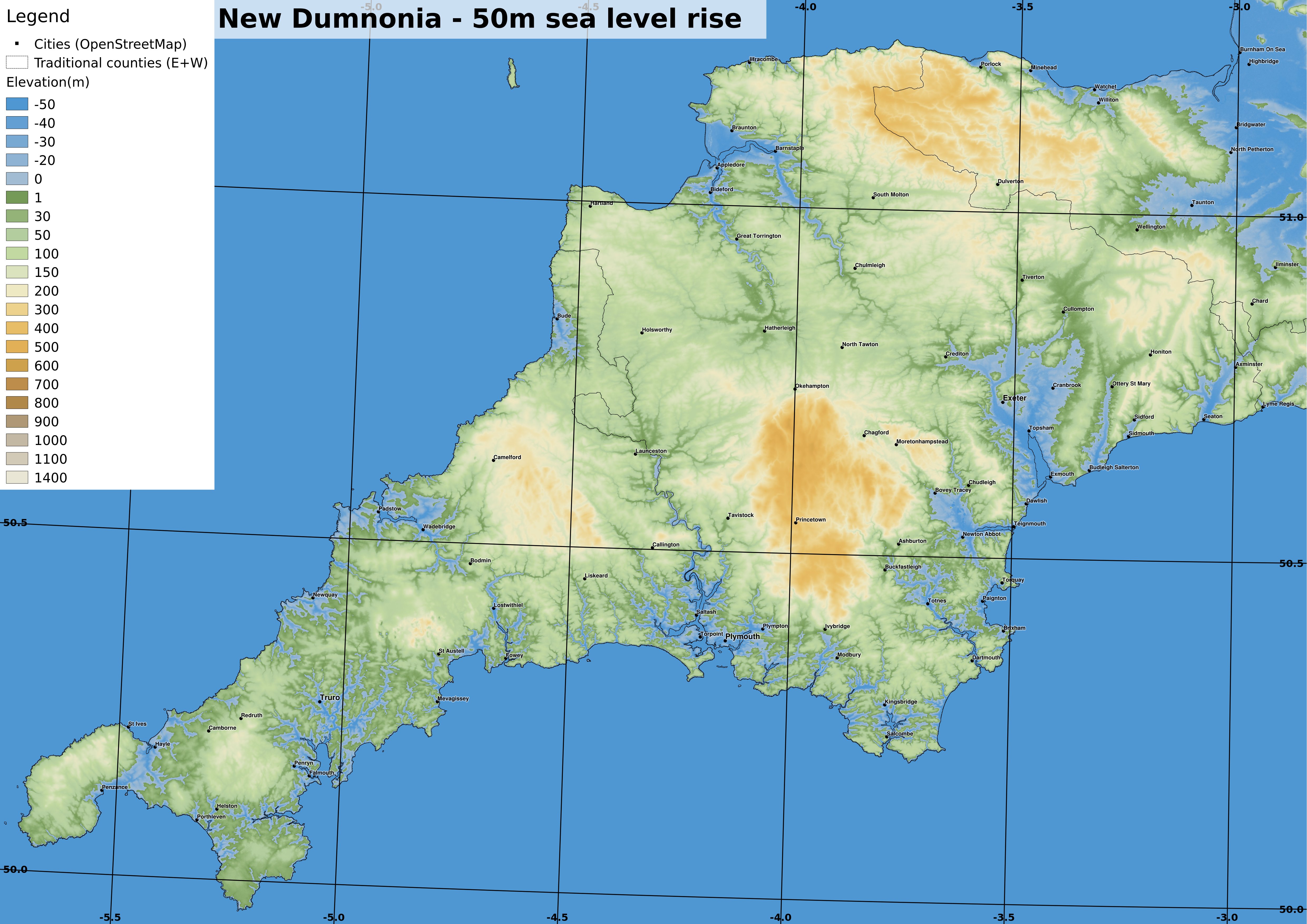
| OS grid ref projection. 1:500000 if printed at A3. Devon and Cornwall now have a much thinner connection to the 'mainland' after the Somerset Levels and the Exe valley sank under the rising seas. Cornwall has a maze of drowned river valleys and is inhabited by two distinct cultural groups, firstly semi-nomadic people travelling in small boats and secondly the upland agricultural settlements. West Penwith is now an island separated by a strait since sea levels were 30m above the pre-industrial level. full-size version |
 |
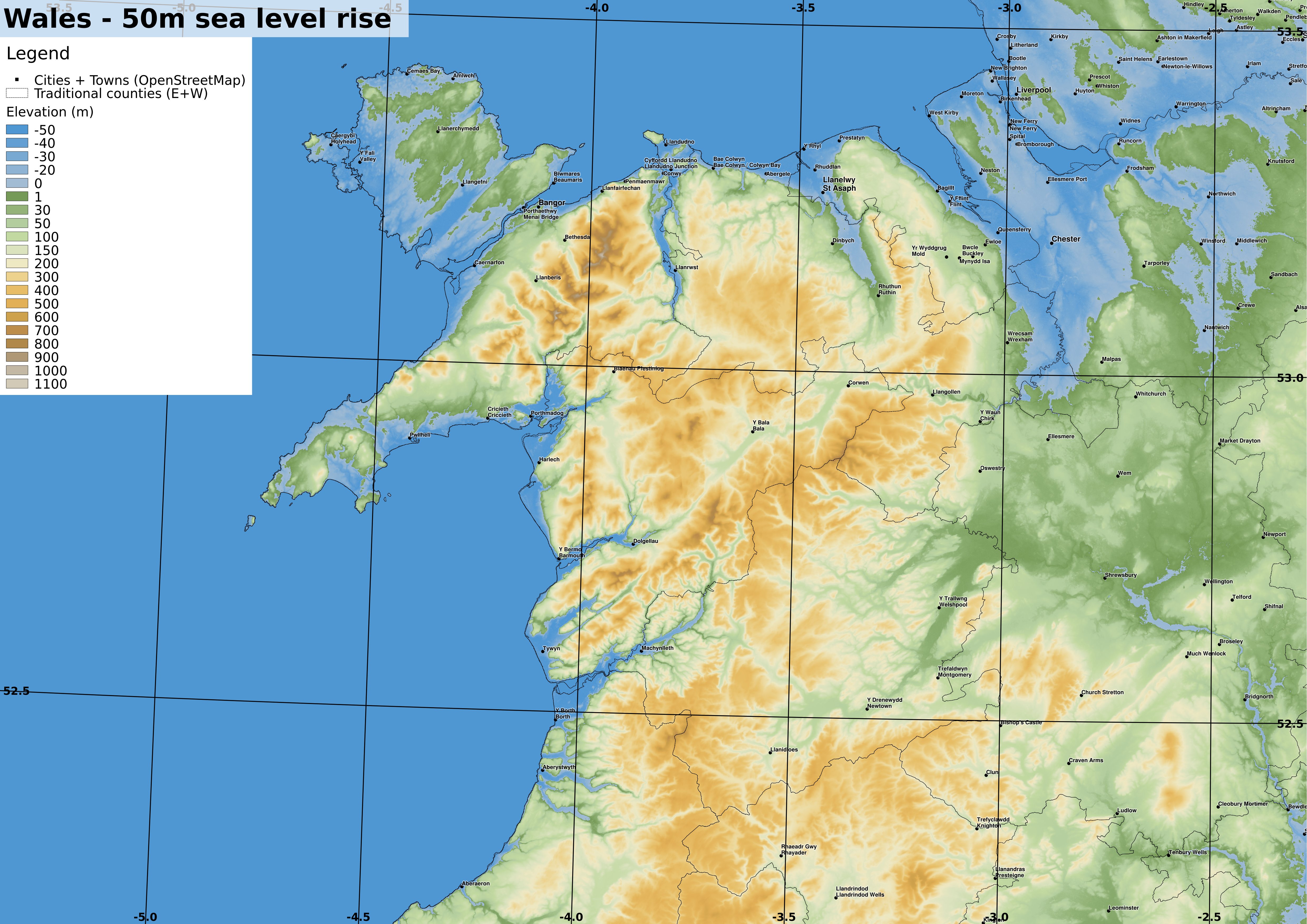
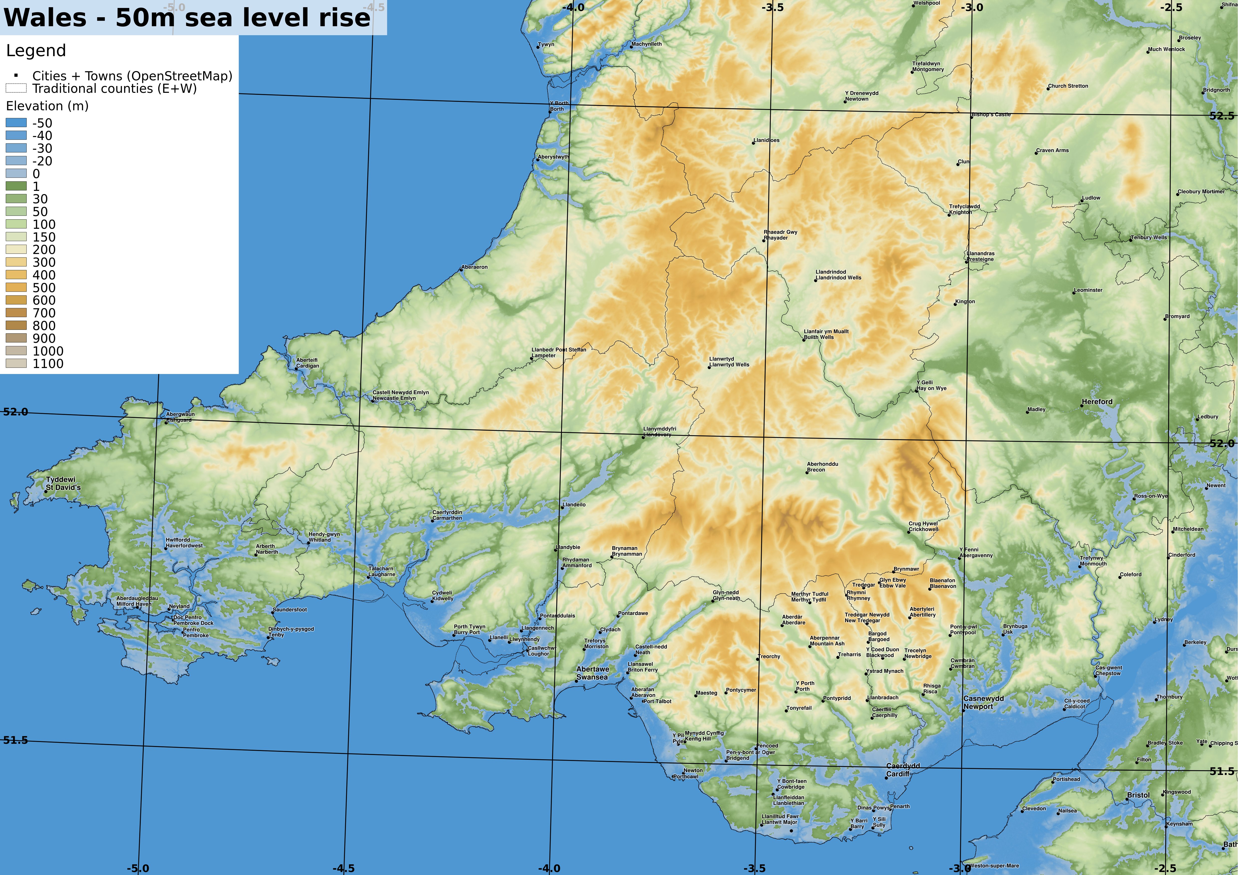
| OS grid ref projection. 1:500000 if printed at A3. Wales is now more deeply incised by river estuaries, with much of Anglesey underwater. full-size version |
 |
| OS grid ref projection. 1:500000 if printed at A3. Similarly to the Cornish coast, some parts of Wales have a maze of islands and small river valleys inhabited by the nomadic boat people. full-size version |


Very clever & interesting geography - sobering too.
ReplyDeleteInteresting speculation - aquatic London seems a trope of speculative fiction - one of Kim Stanley Robinson's Mars books had salvors working in London, even the Victorian era "After London" (available via Gutenberg) had scavengers getting rich from the metropolis' remains (although that involved a whole stack of catastrophes), no doubt others too (J G Ballard?). Here's some atmospheric artwork from a while back: http://www.squintopera.com/projects/all-work/flooded-london/ - all a bit thought provoking, if that was the Meriga idea.
Personally I think 50m sea level rise is more than we should expect even by the 25th century, simply because of the slow speed of melting that much of ice.
ReplyDeleteA complete deglaciation of Greenland, would raise sea levels by 7m, maybe another 1-2m from melting all current mountain glaciers, there would be a few more metres from thermal expansion of the oceans, and the rest would come from melting ice in Antarctica. The melting of all the world's ice sheets would raise sea levels by up to 80m.