Showing posts with label Landserf. Show all posts

Saturday, 15 August 2015

Indicating curvature layers on the slope lines map

In the segmentation discussed in the previous two posts, as well as mean elevation, slope and aspect, I also have two curvature layers, longitudinal, and cross-sectional curvature that I calculated in LandSerf. The definitions of these are explained in the PhD thesis of Jo Wood, the author of LandSerf.

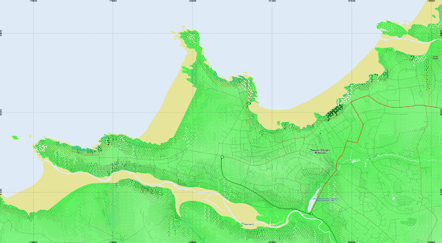
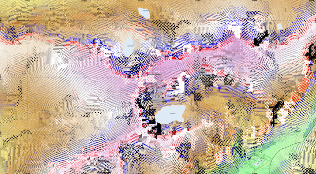
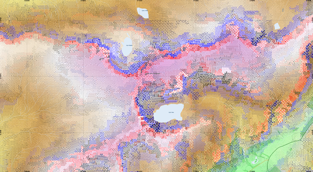
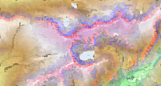
I thought to indicate longitudinal curvature using colour, shading convex slopes in red and concave in blue. Cross-sectional curvature is indicated with dots, which are white for diverging slopes and black for converging. Both of these are normalised by the square root of the segment area relative to the minimum segment area.

Newquay in Cornwall. Convex slopes appear in red, concave in blue.
Cadair Idris. Some strongly curved areas create very large dots that fill entire segments above Llyn Cau

Rescaling the dots to half their radius.
Normalising the radius of the dots by the slope. i.e. reduce dots on steep slopes, and expand those on flatter terrain, such that they are scaled by the magnitude of the cross-sectional curvature relative to the slope. It does get a bit complicated, with the formula for their size in QGIS being "case when  RAT_CrScCrv_Mean > 0 then  5*(90/max(RAT_slope_deg_Mean,1))*RAT_CrScCrv_Mean*(sqrt($area/(14*24*24))) else -5*(90/max(RAT_slope_deg_Mean,1))*RAT_CrScCrv_Mean*(sqrt($area/(14*24*24))) end"

Thursday, 28 August 2014

Analysis of Crater Greg using LandSerf

I had some trouble with geomorphons, because I couldn't get the GRASS 7 extension to compile in Linux for unclear reasons, so I was limited to using the Windows version inside a virtual machine, and it decided to crash when presented with Mars data, although it was OK with Earth DTMs...

I have however been using LandSerf to generate curvature layers, and a feature classification, so here we are, for the well known (at least to Martian glaciologists) crater "Greg":

I hope you're not too confused by the use of transparency...

Units are in metres.

Some of the glaciers form a channel as they are constrained by topography, but not all channels are glaciers.....

Using longitudinal curvature calculated in LandSerf, showing negative curvature where a slope starts off steep and shallows as it goes down, which the Martian glaciers in Greg and elsewhere generally do, (Bryn Hubbard et al.):


Using RSGISLib to segment a layerstack consisting of nadir image, elevation, slope, aspect, and curvature layers:


Selecting all slopes above 15 degrees


Thursday, 7 August 2014

Segmenting with LandSerf: Wales DEM

Using some more SRTM tiles, I will try segmenting the DEM of Wales, using the elevation, slope, aspect, and several curvature layers generated in LandSerf:


 Here is an example segmentation showing the mid-Wales area with RSGISlib with a minimum object size of 80 pixels (0.2sqkm):


Sunday, 3 August 2014

Segmenting Topography with LandSerf and RSGISLib

As a training for segmenting Martian topography, I have done a little work on Earth.

Using the software LandSerf  by Prof. Jo Wood (the website www.landserf.org appears to be down at the moment), I created a number of derived topograhic layers from Shuttle Radar Topography mission data, i.e. slope, aspect, and plan, longitudinal,  cross-sectional, profile and mean curvature. I then layerstacked these files (taking the aspect in degrees from north-facing).


Using RSGISlib to segment these (using min 128px sized objects where a pixel is ~ 72m) I get results like this:

The curvature layers seem to enable it to segment along ridge and valley lines and it can sometimes be seen how the topography is orientated spatially.