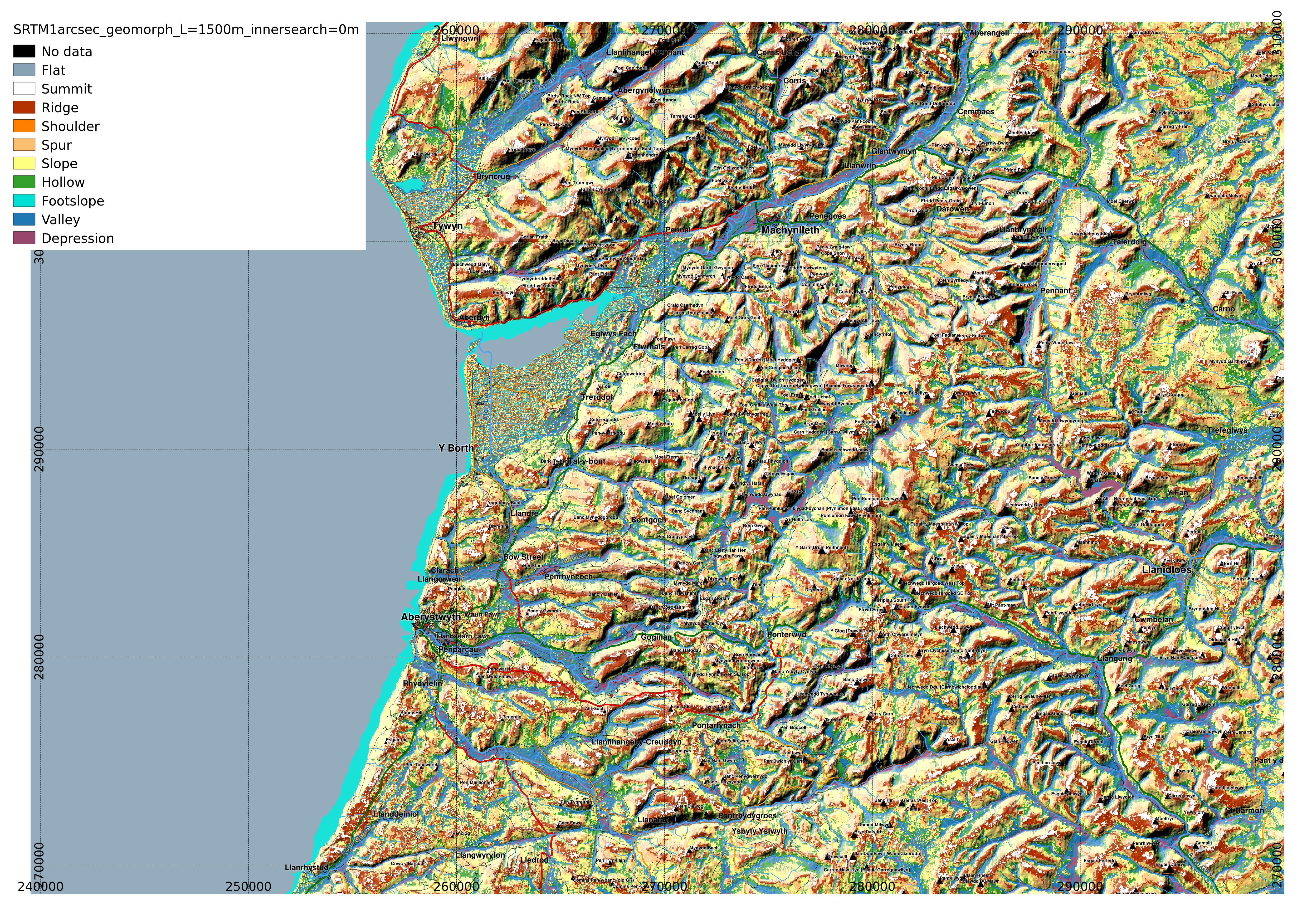
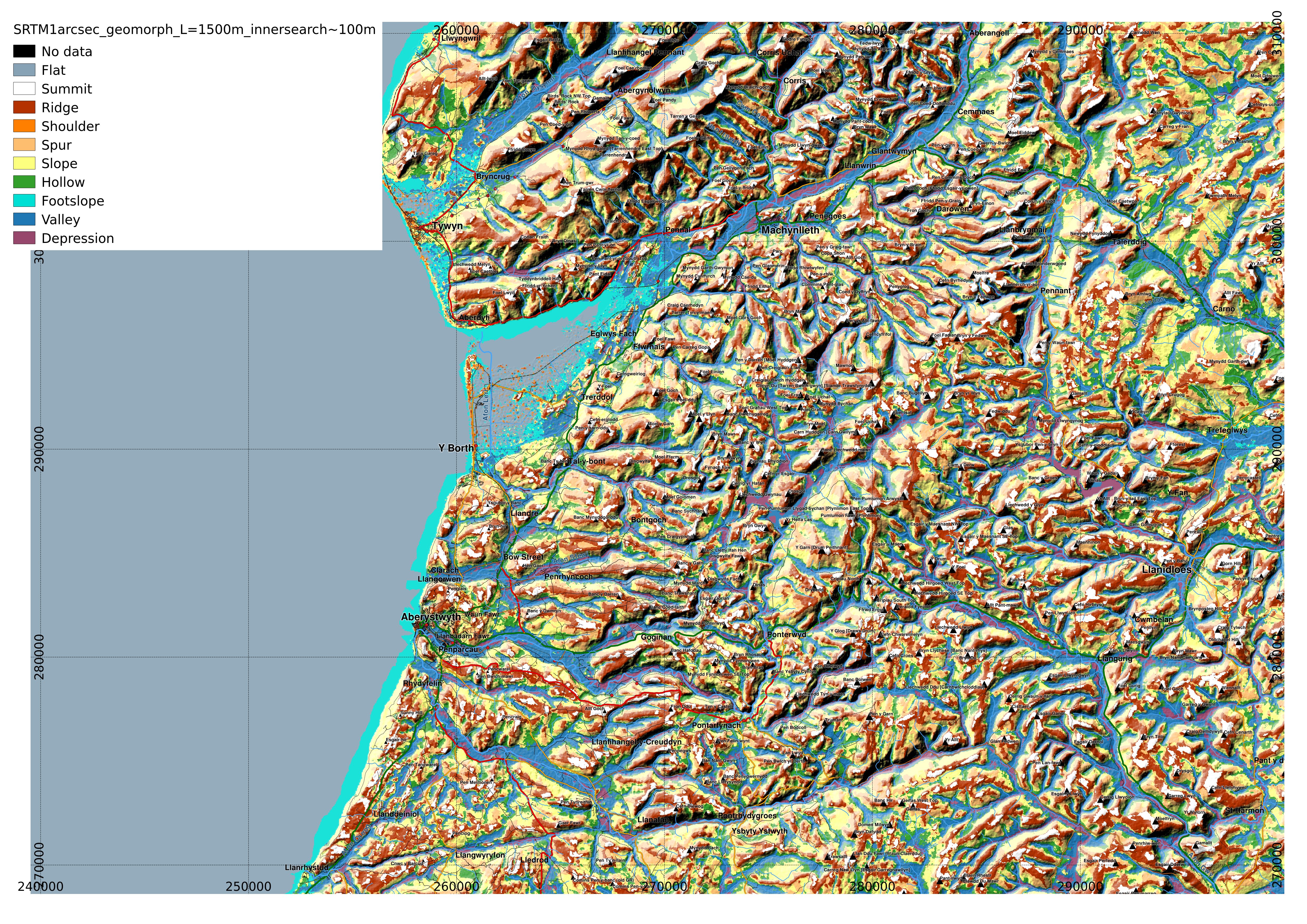
Since then I have become aware of the 1 arcsecond SRTM data being available, so I have recalculated the geomorphons and here show the map of the same area of mid-Wales that the landcover assignment from my MSc was concerned with.
Using the search distance L=1500m, as did T. Stepinski in his geomorphon map of Poland (user guide), I varied the 'inner search radius' which determines the minimum distance the software looks, using 0, 2 and 4 cells. 1 cell is ~ 24m in the SRTM 1 arcsec data after conversion to OS grid reference coordinates.
Inner search radius 0m
 |
| In some of the flatter areas results are difficult to interpret. full-resolution image. |
Inner search radius 2 cells (~50m)
 |
| Looking in Borth Bog, more of the area is shown as 'Flat' full-resolution image. |
Inner search radius 4 cells (~100m)
 | |
| As the inner search radius is expanded to 4 cells, most of the possibly spurious peaks in the flat area of Borth Bog disappear. full-resolution image. |
I expect it would be interesting to combine it with the segmentation and classification with RSGISlib and to examine correlations between the landscape position of a location, and the land-cover.


