The
National Library of Wales recently released a tithe map of St Woolos, Newport to
Wikimedia Commons. There is a crowdsourced
project to digitise, georeference, and transcribe the field names from these maps, however I wanted to try out geoferencing in QGIS with its georeferencing plugin, partly because it may be useful in the
Taves an Tir project that Kowethas an Yeth Kernewek are doing, since scans have also been made of the tithe maps of Cornwall.
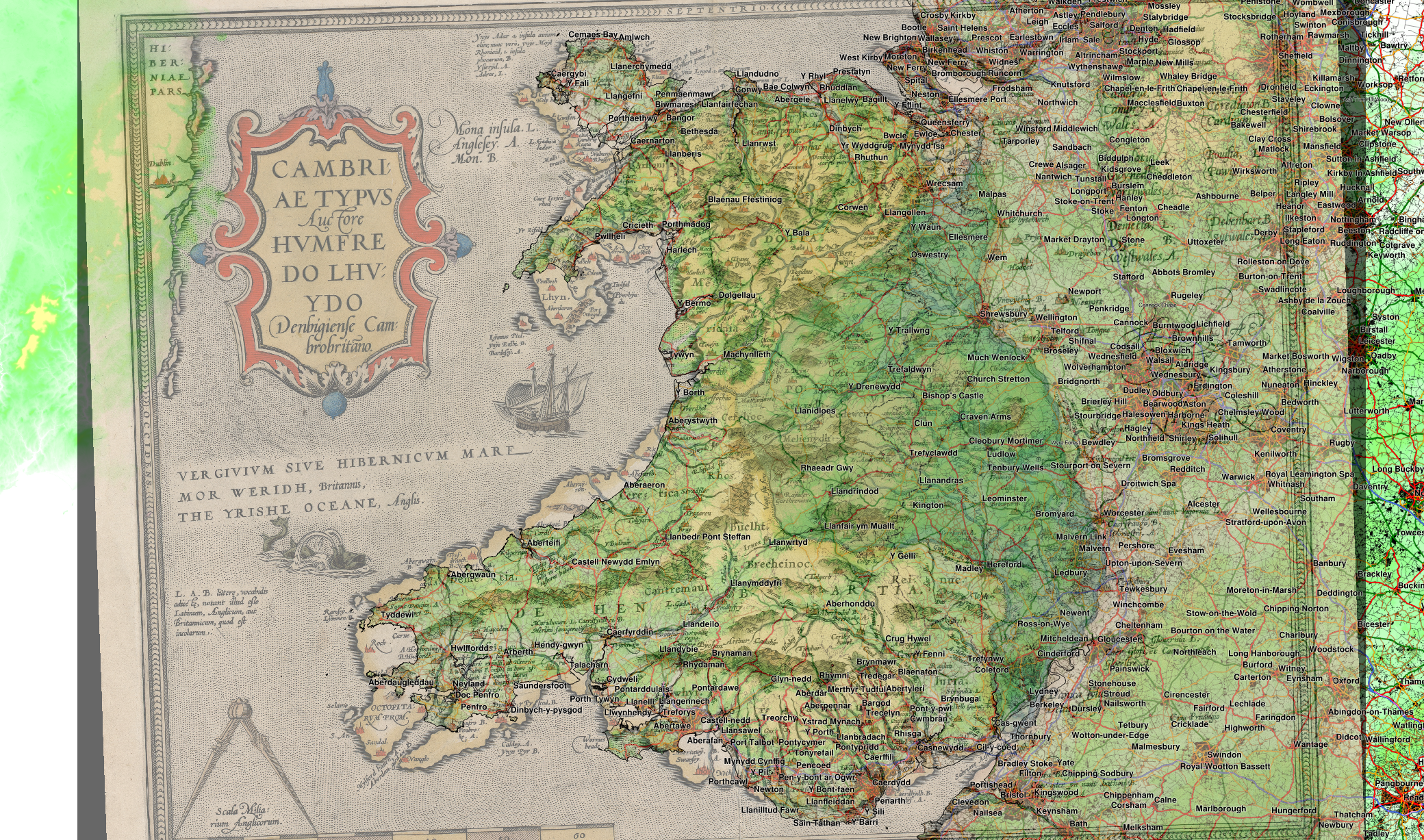
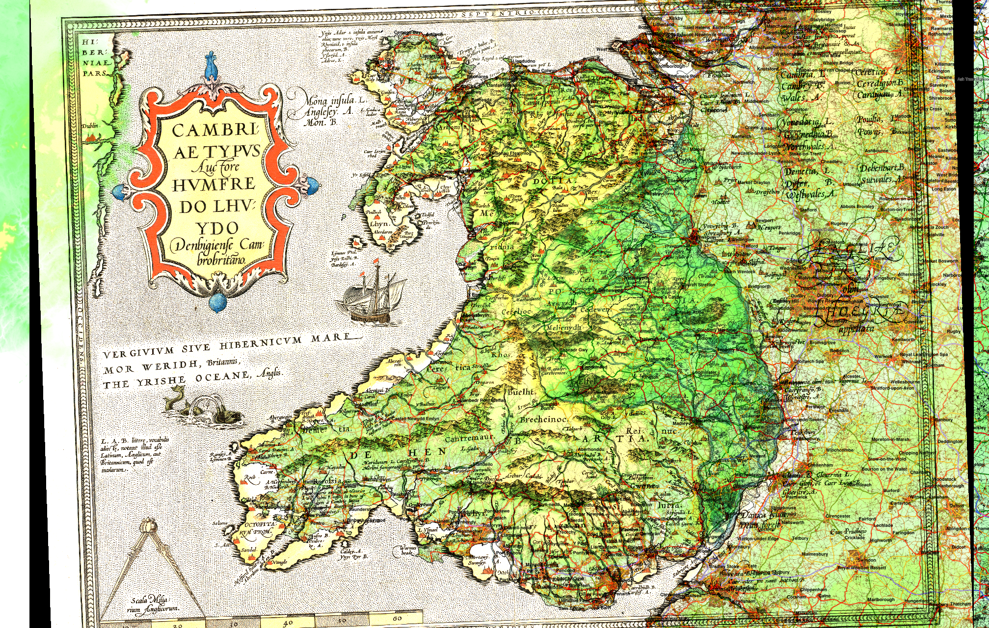
After downloading the full resolution (16,298 × 22,877 pixels) tithe map of St. Woolos, I used the QGIS georeferencer plugin which works by matching manually chosen points between the scan, and a map. In this case I used a map of the UK road network ultimately from OpenStreetMap via
www.mapcruzin.com, as well as some of the OS VectorMap data. This includes railways, woodland areas and parks shown below. I styled the road map in QGIS depending on the category of road.
I used 8 points, finding road junctions that I could match between the two maps and a Helmert transformation (
more information from QGIS web documentation). It was clear when I did this that one of my points was incorrectly placed, which isn't too surprising given the road network has changed since 1845, but discarding this gave a good result.
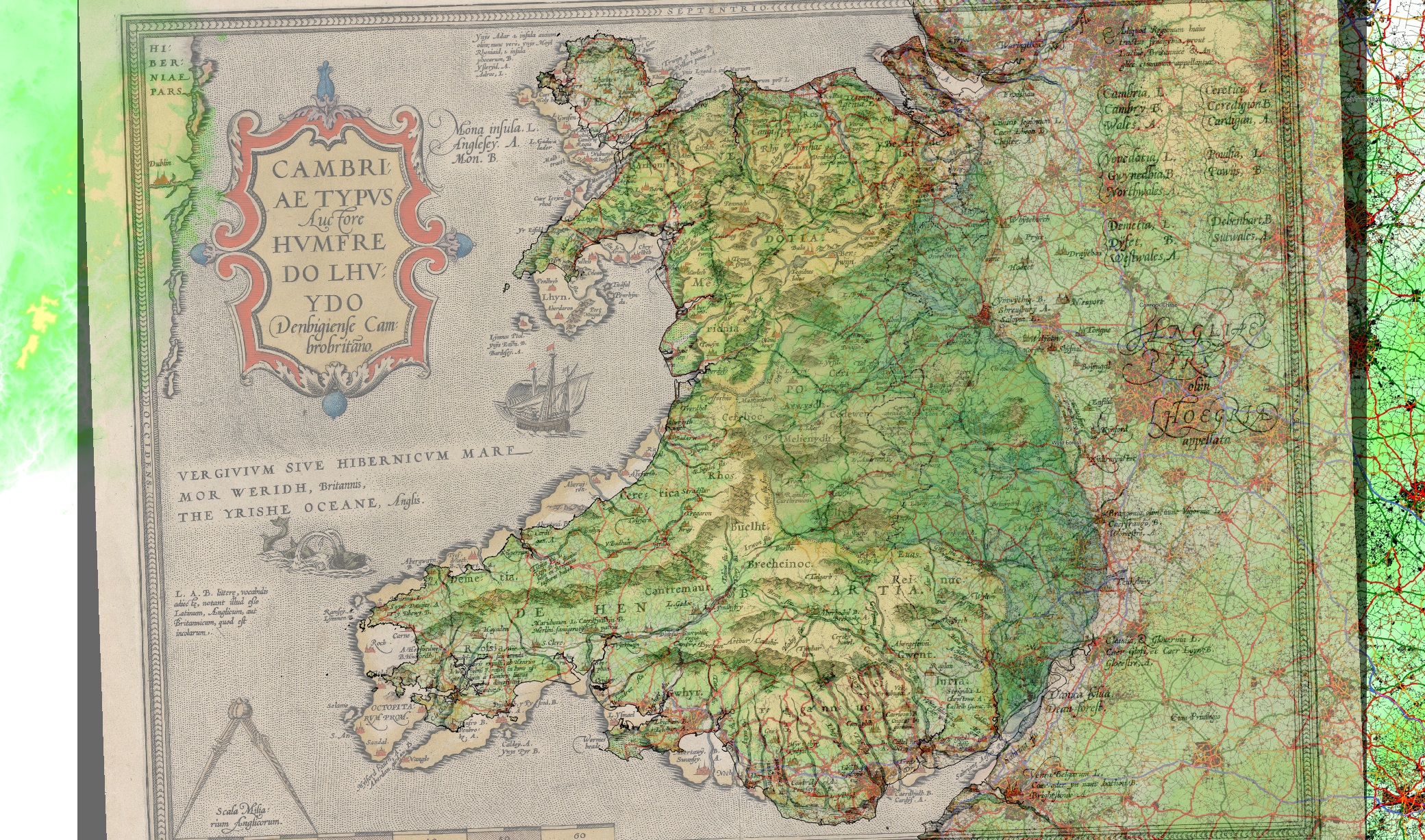
I've also downloaded some of the
1 arcsec resolution Shuttle Radar Topography Mission data, which has recently been made available for most of the world, including the British Isles, and transformed this to a contour map in QGIS.
Below is a map of a portion of the St. Woolas tithe map area, with the modern road network overlaid along with OS VectorMap data for railways, woodland, surface water and parks.
There are many options in QGIS for feature labelling, for instance it is possible to suppress labelling of small features to avoid label overcrowding, which makes it label street names selectively.
Aside - Welsh language names in OpenStreetMap
OpenStreetMap does have some Welsh language names, if the
name:cy tag is used. It is possible to see these using the
Multilingual Map Test site by Jochen Topf.
It is slightly involved to extract this from a download from
http://download.geofabrik.de/ because it is in an 'other_tags' column along with various other things and a bit of string slicing is needed to get it out.
The
name:cy tag is only used where the Welsh language form of the place differs from the version commonly used on English maps.


